


Road Closure Impacting Travel to Big Bear Lake this Winter
September 2025 Update
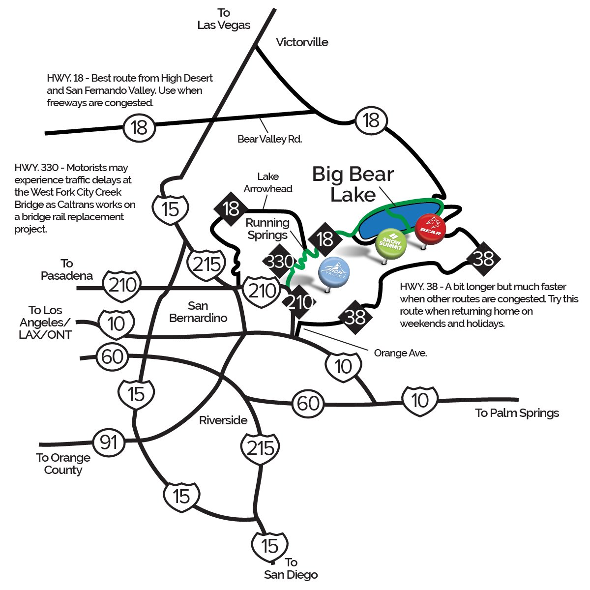
On September 18, 2025, a significant rainstorm caused a major mudslide that washed out portions of Highway 38, the scenic "back side" route to Big Bear Lake. Many travelers use this route to avoid congestion on the “front side” via Highway 330. Unfortunately, the damage to the mountain road is severe, and while CalTrans is actively working on repairs, there is currently no estimated completion date. It could take several months or longer to fully reopen.
With winter operations potentially starting as early as November, we want to start educating you now on an alternative route to Big Bear Mountain Resort. rich-text, responsive-table
With winter operations potentially starting as early as November, we want to start educating you now on an alternative route to Big Bear Mountain Resort. rich-text, responsive-table
rich-text, responsive-table
Take North Shore instead of Big Bear Blvd.
If you are coming from the beach cities (Los Angeles, Orange County, and San Diego counties) and typically take the "front way", we have a new alternative route we are recommending this winter. Once you reach the Big Bear Dam, most navigation apps like Google Maps or Apple Maps will guide you straight through the traffic light heading onto Big Bear Blvd. However, with Highway 38 closed, traffic on this road will be much heavier than usual this winter.
Instead, we recommend you turn left at the light onto the North Shore side of Big Bear Lake. This route allows you to bypass the more congested areas by wrapping around the lake, crossing the bridge, and then continuing on to Bear Mountain or Snow Summit.
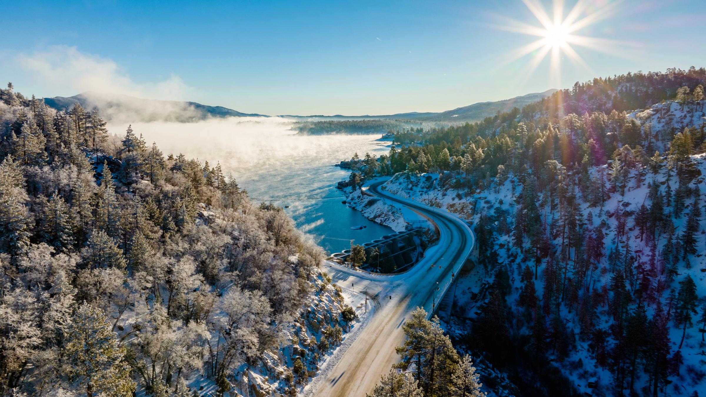
Below is a photo of Big Bear Dam shows where the road splits. Be sure to stay to the left at this point. rich-text, responsive-table
If you are coming from the beach cities (Los Angeles, Orange County, and San Diego counties) and typically take the "front way", we have a new alternative route we are recommending this winter. Once you reach the Big Bear Dam, most navigation apps like Google Maps or Apple Maps will guide you straight through the traffic light heading onto Big Bear Blvd. However, with Highway 38 closed, traffic on this road will be much heavier than usual this winter.
Instead, we recommend you turn left at the light onto the North Shore side of Big Bear Lake. This route allows you to bypass the more congested areas by wrapping around the lake, crossing the bridge, and then continuing on to Bear Mountain or Snow Summit.
Below is a photo of Big Bear Dam shows where the road splits. Be sure to stay to the left at this point. rich-text, responsive-table
 rich-text, responsive-table